
I am working on a presentation about water and I was looking for images that would illustrate how much water is used for irrigation – often in areas that basically are not suited for intensive agriculture at all.
(fact: 70% of global water consumption is for irrigation).
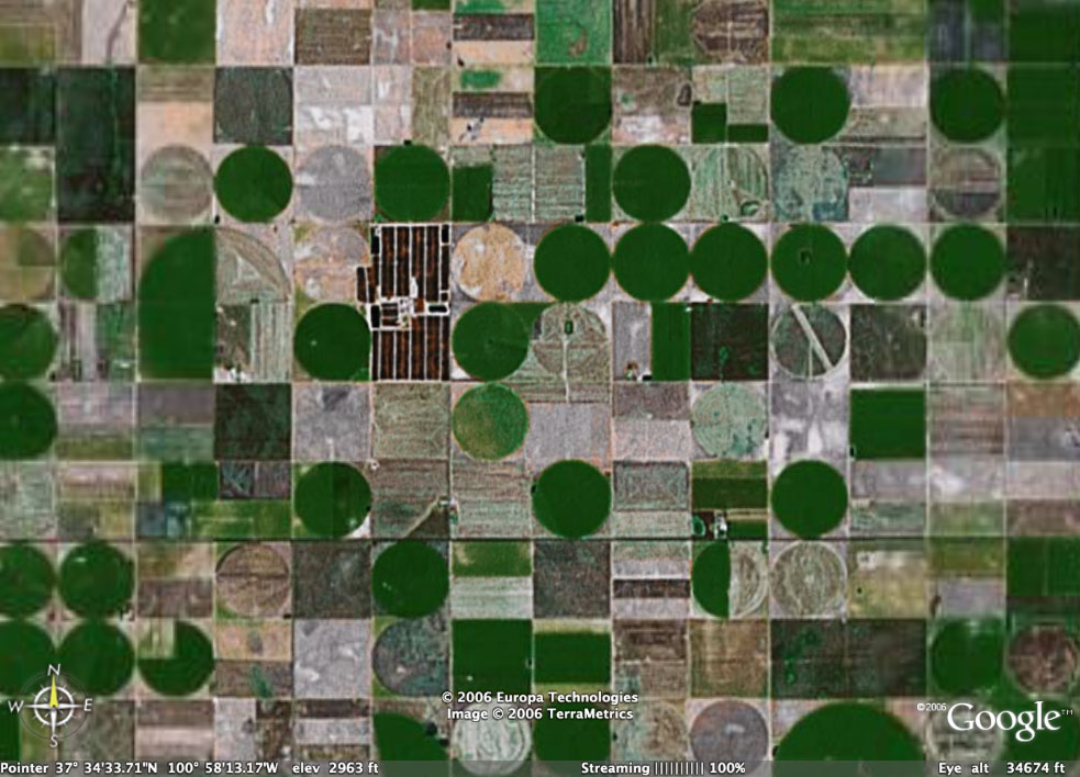
I heard that Garden City in Kansas was a place that used pivot irrigation a lot, and sure enough: if you have a look from the Google Earth satellite, you see this massive example of terraforming.
I can't help wondering what the view will be in a few decades.
No comments:
Post a Comment